Pere Marquette River
Pere Marquette River camping (& other lodging) from east to west
Camping – and one group of lodges - on the riverbanks (east to west)…
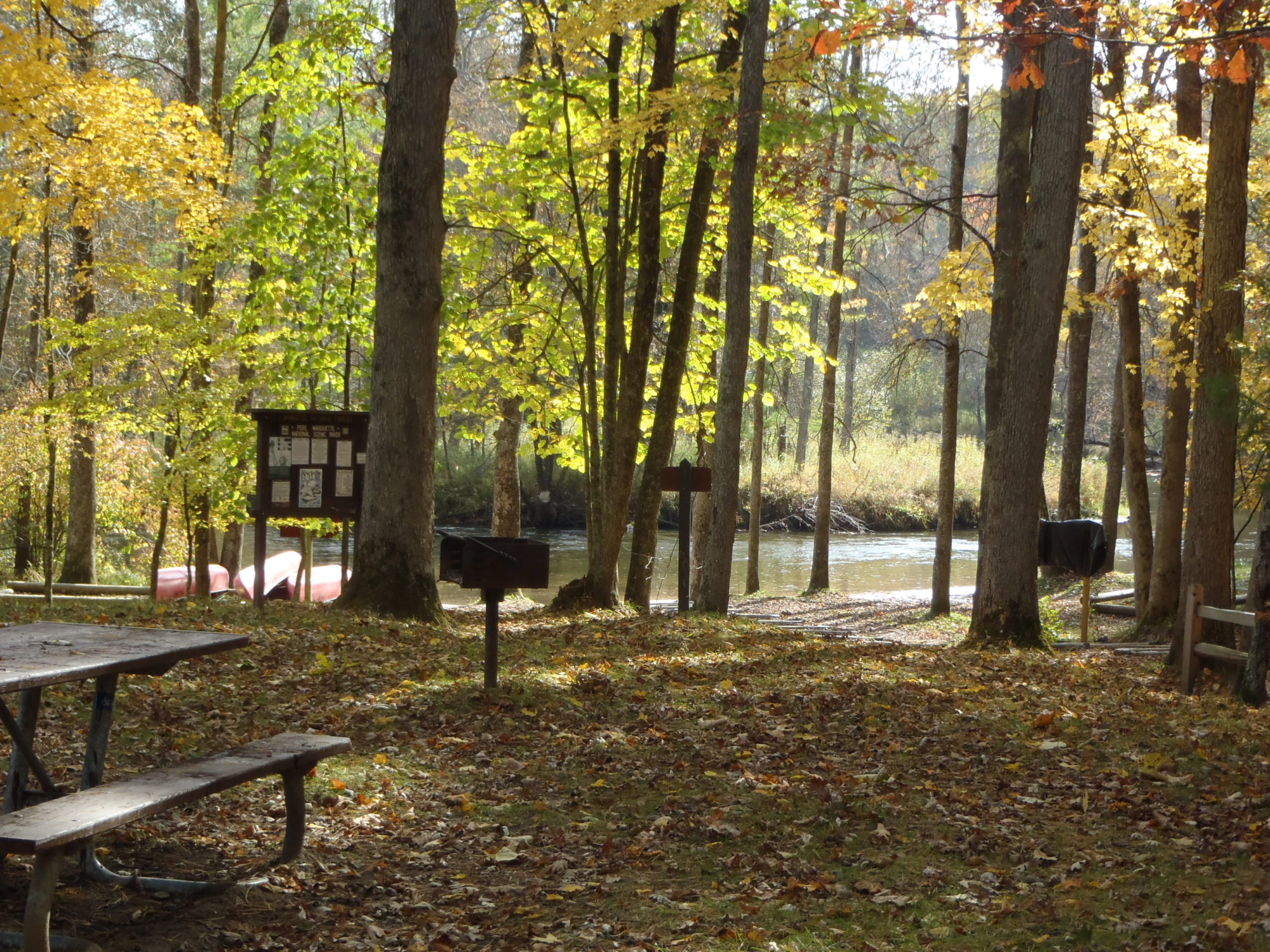
Claybanks (231) 861-8885 www.claybankstownship.org; 6 miles, 2 hours, downstream from the Forks public access; from M37 in downtown Baldwin, take Eighth Street west for one-half mile to Astor Road and turn left (south). Follow Astor Road for .7 mile to 56th St and turn right (west). Take 56th Street for .2 mile to Claybanks Road and turn left (south). Once you’re on Claybanks Road, in 2.6 miles camping sites & multiple restrooms come into view. The water’s access is on the north side of the P.M. and you exit the river to your right. The hill that Claybanks sits upon is very steep (with beautiful wooden steps on the hillside) and a tough place to carry your boats and gear up, so not considered a public access.

Gleason’s Landing (231) 745-8760; a public access 9.5 miles, 3 hours, downstream from the Forks; from M37 in downtown Baldwin, take Eighth St west for one-half mile to Astor Road and turn left (south). Follow Astor Road to the first right that you come to, 52nd Street. Follow 52nd Street west for 2 miles to S Jenks Road – there is a sign for Gleason’s Landing just before 52nd meets S Jenks – and turn left (south) at S Jenks. In .4 mi you hit a split in the road – take the bend right which puts you on to the aptly-named Shortcut Lane. On Shortcut Lane for .4 of a mile you arrive at a stop sign and turn right (west) on to 60th Street. Once on 60th, you drive for .3 of a mile and turn left (south) at S Brooks Road and drive for one-half mile to the north banks of the P.M. Paddling in, the landing is on your right. Camping and toilets are available here.
Bowman Bridge (231) 745-8760; a public access 3.3 miles, 1 hour, downstream from Gleason’s; from M37 in downtown Baldwin, take Eighth St west for one-half mile to Astor Road and turn left (south). Follow Astor Road to the first right that you come to, 52nd Street. Follow 52nd Street west for 2.6 miles (.6 mile past S Jenks) to a split in the road where there is a sign pointing right to Rainbow Rapids (on to Wingleton Road) in 4 miles OR left (as 52nd Street becomes 56th Street) and 2 miles to Bowman Bridge – stay to the left. Once you cross the P.M., the access is to the right. The access is on the P.M.’s south shore, paddling in it’s on your left. There is restrooms and camping at Bowman Bridge. The BB launch site is a gorgeous one.
Sulak (231) 745-4631; a public access 3.2 miles, 1 hour, downstream from the Rainbow Rapids access; from the town of Branch on US10, take Tyndall Road south for one-half mile to Stevenson Road and turn left (east). Stevenson Road will bend right (south) and become S Branch Road. One-half mile south of the P.M. (and the Upper Branch Bridge access) is the left turn on to an unmarked road that takes you to Sulak.
The total mileage from US 10 to the unmarked Sulak turn in is 2.7. There is toilets and plenty of camping at this access, and rapids just downstream. The access launches on the south P.M. banks, on your left as you paddle in.
Elk is a free “canoe-to-only” campsite on your left, 10 minutes downstream from Upper Branch Bridge. It has toilets and fire rings.
Barothy Lodge (231) 898-2340 www.barothylodge.com; private landing 5.7 miles, 2 hours, downstream from Lower Branch Bridge access; take US10 to town of Walhalla, south 1.7 miles on to Walhalla Road, then east/left on to Barothy Road, then 1 mile to Barothy Lodge; 15 rental lodges on 320 acres along a 4-mile stretch of the Pere Marquette.
Henry’s Landing and Canoe Livery (231) 757-0101 www.henryslanding.com; located across the river from the public access at the Scottville Road Bridge; from US10 in downtown Scottville, take Main Street south as it becomes Scottville Road. The P.M. is one mile south of US10. Immediately after crossing the river, turn right into Henry’s. To reach Henry’s from the P.M., paddle beneath the bridge and exit on the left (south) shore on the downstream end of the camping area. Every campsite is along the banks of the P.M. Restrooms are on the grounds.
Camping off-river (east to west)…
Pere Marquette Campground (231) 480-0303 www.koa.com/campgrounds/pere-marquette; not located along the river (the nearest public access is Sulak, a 1.5 mile drive away); from the town of Branch on US10, take Tyndall Road south for one-half mile to Stevenson Road and turn left (east).
Stevenson Road will bend right (south) and become S Branch Road. 1 mile south of the P.M. (and the Upper Branch Bridge access) and at the top of a hill, turn right (west) on to 40th Street. The campground is in one-half mile.
Buttersville Park (231) 843-2114; not located on the river & a 3-minute drive away from the Father Marquette Park & Shrine public access; from downtown Ludington, take US10 east to Pere Marquette Highway and turn right (south). Go 2 miles, crossing over the north and south branches of the P.M., and turn right on to Iris Road. Take Iris for 1.6 miles until it ends at South Lakeshore Drive and turn right (north). It’s a little over a mile to Buttersville Park (if you arrive at the Father Marquette Park & Shrine – the furthest west P.M. access - you’ve gone 3 minutes too far). Camping-restrooms-pavilion-picnic tables-swings ‘n slides are available at Buttersville Park, along the Lake Michigan shore on Lakeshore Drive. Beautiful shaded grounds, many sites with wonderful Big Lake views. Everything from tents to RVs sets up shop here.
Pine River
Pine River camping (& other lodging) from east to west
Camping on the riverbanks (east to west)…
Silver Creek (231) 745-4651; located at the Walker Bridge public access, 6.6 miles, 2 hours, downstream from the Skookum South access; US131 exit 168/20 Mile Road, drive 6 miles west on 20 Mile Road which becomes 8 Mile Road. 2 miles after passing through the town of Bristol, turn north/right on to Sadler Road for 1 mile to 9 Mile Road and turn west/left. Follow 9 Mile until it ends at State Road. Turn south/left on to State Road to west/left-hand turn to Silver Creek Campground.
Lincoln Bridge (231) 745-4651; located 2.1 miles, 30 minutes, downstream from the Walker Bridge access; US131 exit 168/20 Mile Road, drive 6 miles west on 20 Mile Road which becomes 8 Mile Road. 2 miles after passing through the town of Bristol, turn north/right on to Sadler Road for 1 mile to 9 Mile Road and turn west/left. Follow 9 Mile until it ends at State Road. Turn north/right on to State Road and drive 1 mile to 10 Mile Road – turn west/left to Lincoln.

Coolwater (231) 862-3481 www.coolwatercampground.com; located 1.7 miles, 27 minutes, downstream from the Dobson Bridge access; from the M55 & M37 junction, take M37 south (crossing over the Pine) and 2.5 miles. Turn east/left at W 48&1/2 Road at Kestelwoods Restaurant corner. Continue past Kestelwoods Campground to Coolwater, on south bank of the Pine.
Peterson (231) 723-2211; across the river from the Peterson Landing access; from the M55 & M37 junction, take M37 south 1.5 miles. Just past the Pine River, turn east/left to campground.
Pine River Paddlesports Center (231) 862-3471 www.thepineriver.com; 5 minutes downstream from Peterson’s Landing access; from M55 & M37 junction, take M37 south across the Pine River and turn west/right.
Loomis Landing Campground & Marina (231) 848-7449 www.loomislanding.com; 1.6 miles, 30 minutes, downstream from the Low Bridge access; from M55 & M37 junction, take M55 west for 4 miles. Turn north/right at Moss Road. Follow Moss for one-half mile to Husier Road and turn west/left. Take Husier for 1 mile to Loomis.
US Forest Service Camp Site 41 (231) 723-2211; paddle-in only (1) one-half mile downstream from Loomis Landing OR (2) across Tippy Dam Pond from the Norman-Dixon boat ramp (from M55 & M37 junction, take M37 west 6 miles to Snyder Road & turn north/right for 1.5 miles to Robinson Road & turn east/right for one-half mile).
Cabins & Camping off-river (east to west)…
Logjam (231) 829-3727 www.logjamonthepine.com; an estimated 3 paddling hours upstream from the easternmost (first) public access of Edgett’s; from US131 exit 168/20 Mile Road, follow east-west 20 Mile Rd west for 4 miles to Lakola Road and turn south (left). Take Lakola Rd south for 2 miles to the big left-hand turn on to 17 Mile Road (the only way you can go) and drive into Riverbank. Logjam will be on your left, just before crossing the Pine River.
Edgetts Lodge (248) 894-5115 www.edgettslodge.com; 15 minutes upstream from the easternmost (first) public access of Edgett’s; from US131 exit 168/20 Mile Road; travel 5 miles west on 20 Mile Road to Bristol and turn left (south) on to Raymond Rd (at BP Station); go 3 miles to Pine River – turn in at 3rd left past the Pine River Bridge.
Coyote Crossing Resort (231) 862-3212 www.coyotecrossingresort.com from M55 & M37 junction, take M55 east for 6 miles, turn south/right at Coyote Crossing.
Sportsman’s Port (231) 862-3571 www.sportsmansport.com; from M55 & M37 junction, take M55 east & Sportman’s will be on your right.
Kestelwoods Campground (231) 862-3476 www.kestelwoodscampground.com from the M55 & M37 junction, take M37 south (crossing over the Pine) and 2.5 miles. Turn east/left at W 48&1/2 Road at Kestelwoods Restaurant corner to campground.
Peterson Creek Cabins & Camping (231) 862-3508 www.petersoncreek-cabins.com; take north/south M37 one-half mile north of east/west M55, Peterson on the left/east side of M37
Twin Oaks Campground & Cabins (877) 442-3102 www.twinoakscamping.com; from M55 & M37 junction, take M55 west for 4 miles. Turn north/right at Moss Road & drive 1 mile to Twin Oaks.
Buehler’s Buck Stop (231) 848-4307; from M55 & M37 junction, take M55 west for 7 miles to Baker Road & turn north/right. Follow Baker for 2 miles to Buehler’s on your left at 848 N. Baker Road.